Attribution
Images and data on this website are provided courtesy of the
Space
Science and Engineering Center (SSEC)
UW-Madison. The
AO&SS Rooftop Camera images are a joint project between SSEC and
the
Department of Atmospheric and Oceanic Sciences (AOS).
These images and data are freely available for noncommercial use - we only ask that proper
attribution is given. The following attribution for the AO&SS Rooftop Camera images should be
used:
UW-Madison SSEC/AOS ( or
UW-SSEC/AOS if you need a shorter
attribution ).
For all other data and imagery on this website please acknowledge:
Space Science & Engineering Center UW-Madison ( or
UW-Madison
SSEC ).
 Realtime Tower Data
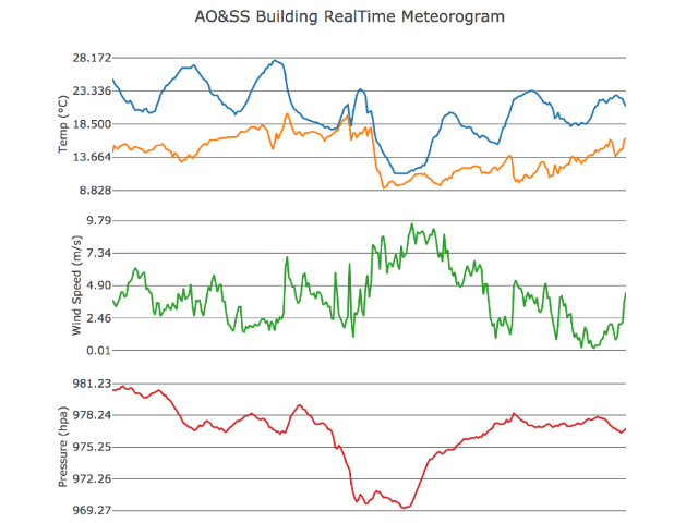
 Realtime Buoy Data
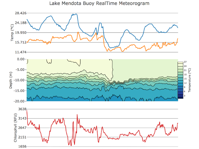
 Quicklook Browser
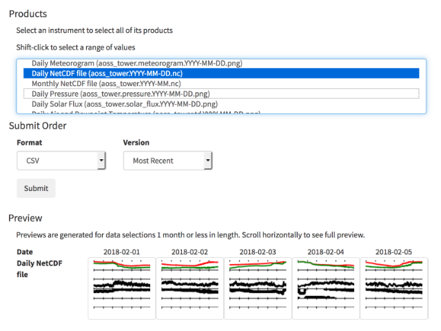 Data Download Form