The Space Science and Engineering Center at the University of Wisconsin-Madison, in collaboration with other departments including Atmospheric and Oceanic Sciences Department, Department of Limnology, and Environmental Engineering, maintain several environmental instruments for research purposes, collectively called "RAIN" or "Reliable Automated Instrumentation Network." On this website you can find more information about these instruments as well as view and download the data measurements collected by these instruments.
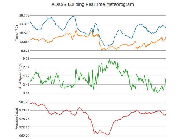 Realtime Tower Data
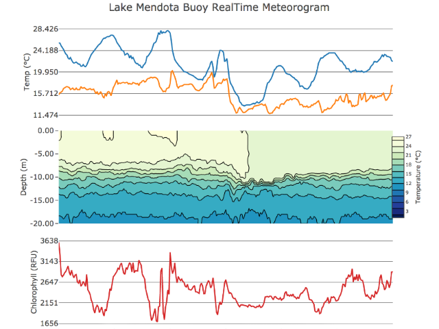 Realtime Buoy Data
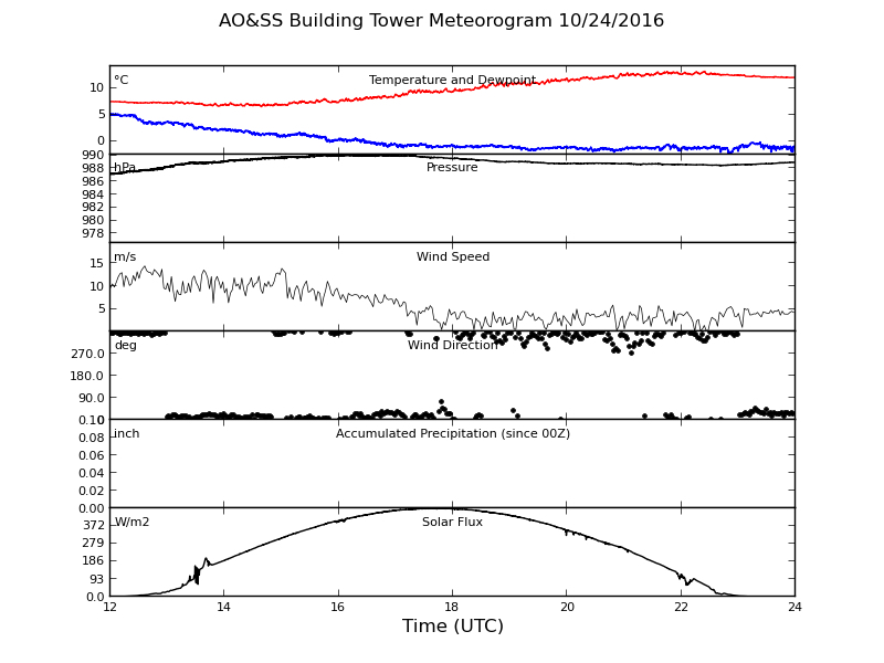 Quicklook Browser
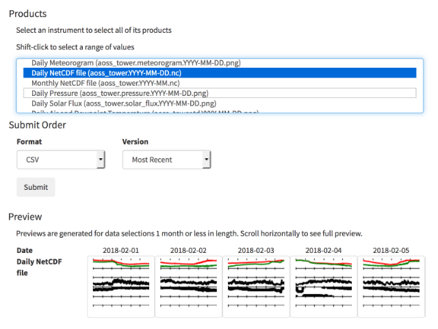 Data Download Form